Water expected to begin passing over the Chilcotin River landslide soon
-
Share on Facebook
-
Share on Twitter
- Copy Link
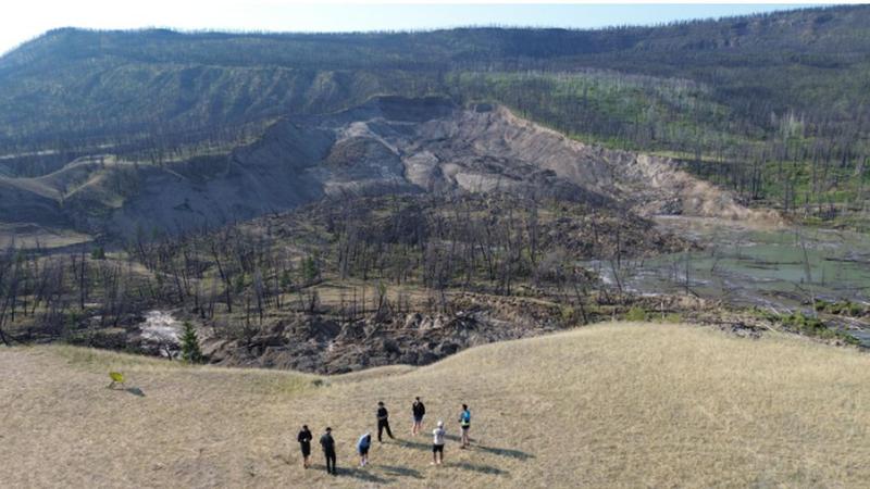
VICTORIA — New modelling suggests water will start to move over overtop the landslide along the Chilcotin River Sunday (Aug. 4) or early on Monday.
In a news release Sunday afternoon, provincial authorities say in the best-case scenario, it is anticipated that it will take 12 to 24 hours for the trapped water to pass through the blockage. The scenario predicts flows below typical spring flooding peaks on the Fraser River but significantly higher than usual on the Chilcotin River. If the water moves through in 12 hours, the Chilcotin River could see peak flows over 10 times greater than a typical freshet peak. In the 24-hour scenario, peak flows could be over seven times greater.
The worst-case scenario involves rapid drainage of the lake behind the dam within one hour, resulting in significantly higher flows on the Chilcotin River and flows at or below freshet peaks on the Fraser River. This could cause the Chilcotin River to rise to 21 meters at the Farwell Canyon bridge and 12 meters at its confluence with the Fraser River. Peak flows could reach Lillooet in 12 to 13 hours. Updated modelling data has been shared with communities that could be impacted.
Since the landslide on Tuesday, there has been minimal water seepage through the natural dam, causing the water level behind the dam to rise steadily at approximately 18 centimeters per hour.